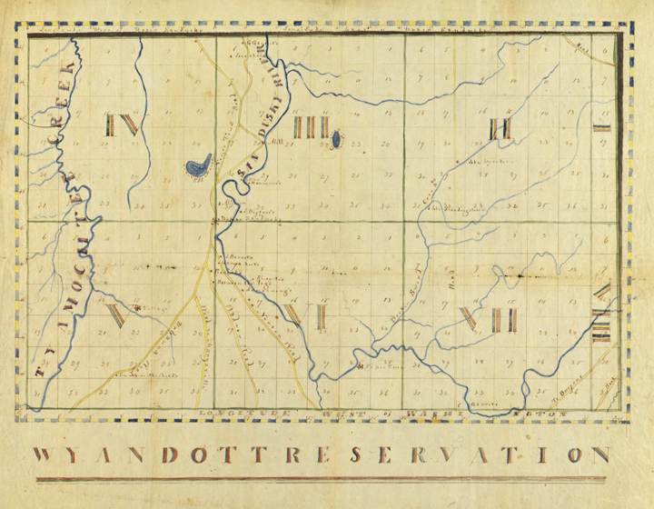
Wyandot Reservation
This is a hand drawn map of the Wyandot Reservation in the 19th century near Upper Sandusky, Ohio. The reservation has been blocked off in eight sections numbered with Roman numerals. On the map Wyandot is spelled 'Wyandott.' The Wyandot lived on this reservation from 1818-1842 when they relinquished their claim to the land. Ohio History Connection Image AL07671.
Click the image for a printable version.
Click the image for a printable version.